Every Home Has Flood Risk: Explaining Flood Zones to Clients
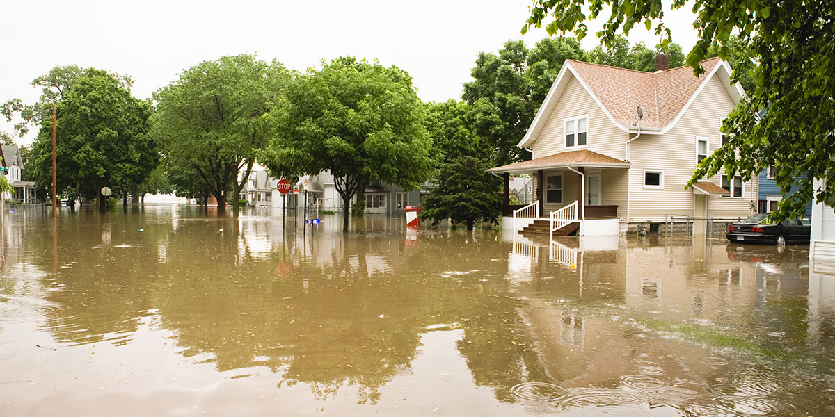
Approximately 9.8 million properties face significant flood risk despite sitting outside of the Federal Emergency Management Agency’s high-risk flood zones. That helps explain why many homeowners underestimate their exposure. FEMA flood maps remain an important tool, but they are built primarily around mapped flood hazards associated with major rivers, lakes and coastlines. They do not fully capture every source of flooding, including flash flooding, stormwater runoff or heavy inland rainfall.
“If you look at the federal flood insurance rate maps and zoom out, you'll see this capillary system across the country, with the vessels representing waterways and coasts. The mapping exercise managed by FEMA that produced the Flood Insurance Rate Maps, is essentially say that if you live within a certain distance of an established waterway, then you're at risk of flooding,” says John Dickson, President of Aon Edge. “But the truth is that rainfall is generating more flooding events than ever. The true risk of flooding is not limited to those capillaries that are interspersed throughout the country. It's anywhere there's land.”
Required Coverage vs. Actual Risk
That distinction is important because a standard homeowners policy typically does not include flood coverage. If a client assumes their homeowners policy could cover them, or that being far from water makes them safe, that assumption can create a false sense of security.
Only homeowners in Special Flood Hazard Areas (SFHA), specifically any A or V zone, are required to purchase flood insurance if they have a federally backed home loan. While A and V zones are riskier, floods can and do occur in every zone, including the lower-risk B, C, and X zones.
Flooding can occur in a range of environments, including areas outside FEMA’s highest-risk flood zones. Flood risk is not bounded by the FEMA 100 year floodplain, and a meaningful portion of exposure and loss can occur outside mapped FEMA flood zones. In fact, nearly 40% of National Flood Insurance Program claims come from properties mapped outside high-risk SFHA zones.
Flood Risk Is Not Limited to Coastal Areas
As the frequency of extreme precipitation events increase, heavy precipitation is no longer limited to the coast. Coastal storms and hurricanes are often associated with flooding, but flooding is also happening in the Midwest, the Southwest, and basically all regions of our country. Several factors can contribute to flooding, including heavy rains, overburdened drainage systems, rapid runoff, and terrain.
Desert areas
Dry ground may absorb water poorly during intense rainfall, increasing runoff and flash flooding risk. In dry areas of the U.S., including the desert Southwest, compacted ground can struggle to absorb water, making those areas more prone to flooding when precipitation occurs. California’s multiyear drought, followed by heavy rainfall in the winter of 2022–2023, showed how dry conditions can contribute to severe flooding and debris flows when intense storms arrive. The recent flash flooding event in Ruidoso, New Mexico, offers a compelling example of the devastation possible when heavy rainfall meets severely dry ground.
Urban areas
In cities and developed areas, flooding can occur when rainfall exceeds the capacity of local drainage infrastructure or stormwater systems. The U.S. has millions of miles of storm sewers, hundreds of millions of storm drains and millions of stormwater treatment assets, while impervious surfaces continue to expand. As more land is covered by pavement and development, stormwater runoff can increase and contribute to urban flooding. During Hurricane Harvey, extensive development and impervious surfaces intensified flooding across the Houston region. In a particularly striking example, an elevated section of Interstate 10 and its solid, concrete mediate acted as a dam, keeping one side of the highway open while impounding water on the adjacent side that resulted in the flooding of homes, farms, ranches, and businesses.
Mountain regions
Communities near mountains and hills can face flood and debris-flow risk when water moves quickly downhill, especially after wildfires damage vegetation. Research indicates that recently burned basins may face elevated debris-flow risk compared with unburned basins under certain storm conditions. In southern California, as little as 7 millimeters of rainfall in 30 minutes has triggered debris flows, and storms with intensities greater than about 10 millimeters per hour can pose debris-flow risk.
Valleys and low-lying areas
Heavy rainfall can overwhelm local drainage systems, causing water to accumulate in valleys and low-lying areas, increasing flood exposure even when a home is far from the coastline.
What the Data Says
Ninety percent of natural disasters involve flooding, making it one of the most common natural hazards in the United States. As we’ve examined, flood losses are not limited to a small set of well-known coastal locations, and the number of U.S. properties with substantial flood risk is projected to grow to roughly 16.2 million by 2050.
Homeowners in Lower-Risk Zones May Wish to Consider Flood Insurance
Homeowners in SFHAs are often required to carry flood insurance if they have a federally backed mortgage. Outside those areas, homeowners may wish to consider flood insurance depending on property characteristics, lender requirements, and individual circumstances.
How Agents May Approach Conversations About Flood Risk
The best conversations are educational. Agents can help clients understand that:
- FEMA zones describe levels of mapped flood risk and help determine when coverage is required.
- A high-risk designation does not mean a loss is certain.
- A lower-risk designation does not mean zero exposure.
- Flood damage may occur in a range of environments, including some locations outside FEMA's highest-risk zones.
Beyond clarifying that homeowners insurance does not include flood coverage, agents may also want to point to recent flood events, updated modeling, or regional rainfall patterns, using approved data and citations.
Final Thought
Flood risk is broader than many homeowners think. FEMA maps remain an important tool, but they are only one part of the picture. Geography, rainfall, runoff, infrastructure, and local conditions all play a role in how much risk a homeowner may face.
Disclaimer
This material is provided for general informational purposes only and is not intended to provide individualized business, insurance or legal advice. All descriptions, summaries or highlights of coverage are for general informational purposes only and do not amend, alter or modify the actual terms or conditions of any insurance policy. Coverage is governed only by the terms and conditions of the relevant policy.